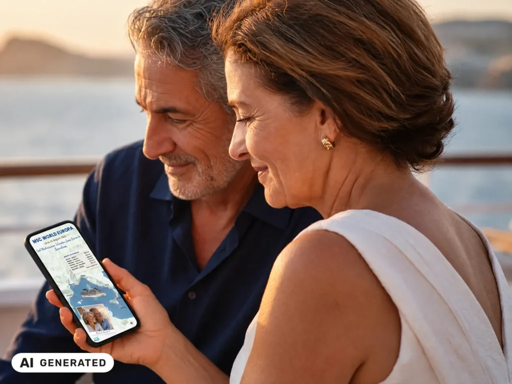
The version you'll be proud to share.
Turn your route into your story.
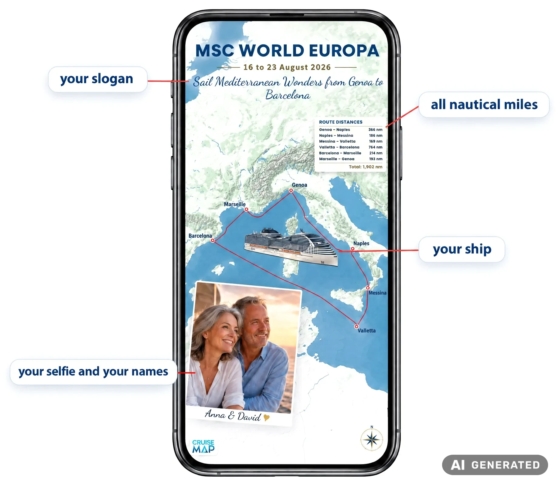
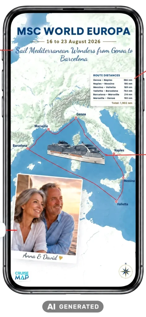
Your cruise in one personal picture: with your favorite photo, your names, a ship illustration, your own slogan and every nautical mile. Ready-made for your story, your feed and the family chat.
$19.95 · instant digital download, no shipping · free preview
- More than 350 shipsYour route is calculated automatically
- 9 social media formatsno cropping needed
- Ready in minutesright in your browser, no app
- Before or after your cruisevia sea routing or from your ship's position data
Pure shows your route. Personalized tells your story.
The free CruiseMap social Pure is a beautiful map. Personalized turns it into a picture with you in it.
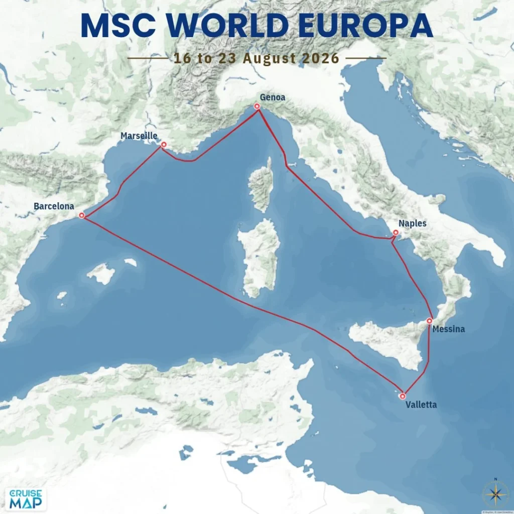
social Pure, free
Your route as a beautiful map
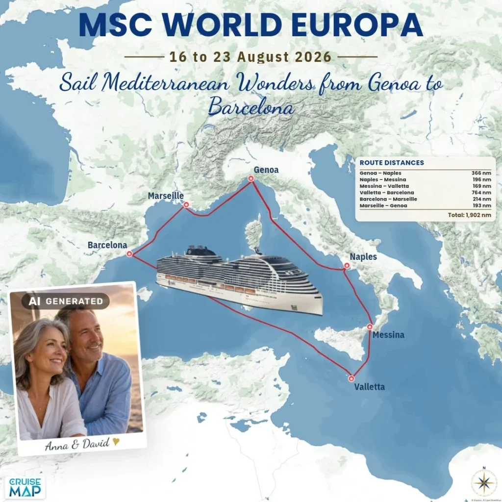
social Personalized, $19.95
Your route as your personal story
| On the map | social Pure | social Personalized |
|---|---|---|
| Original route, ports, travel dates | yes | yes |
| Your photo with your names | – | yes |
| Ship illustration on the route | – | yes |
| Your own slogan | – | yes |
| Distance table with every nautical mile | – | yes |
Four things turn the map into your map
Your favorite photo with your names
You are right there on the map, in an instant-photo frame, signed with your names. That is how a route map becomes your memory.
With ship illustration
The ship that was your home for a few days sails along on your route as an illustration. Many ships already have their own silhouette.
Your own slogan
Romantic, funny or heartfelt. You give your cruise its title.
Every leg and every nautical mile
The distance table shows each leg from port to port and the total distance. The number someone is bound to ask about.
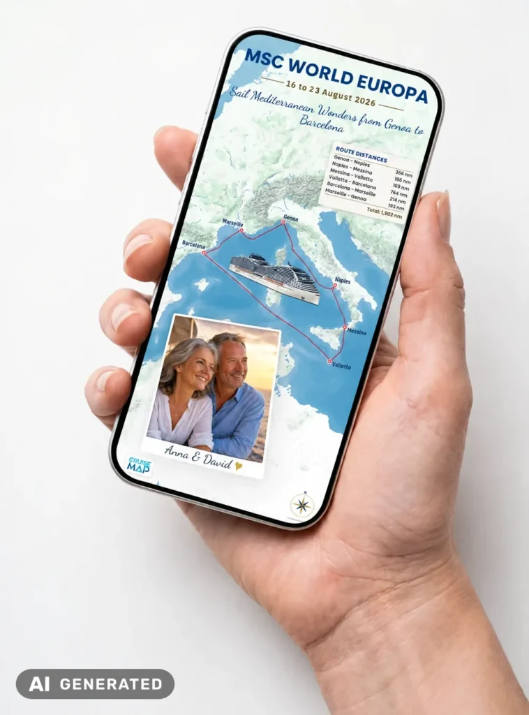
Your cruise in one picture
“So, where did the cruise take you?” Just show them your CruiseMap.
A cruise is more than ports and nautical miles. It is the ship that was your home for a few days, the places you discovered, and that one photo that instantly brings back how the trip felt.
CruiseMap social Personalized brings it all together. Your route is the foundation. On top come your favorite photo with your names, the ship illustration, your own slogan and the distance table with every leg. People see not only where you went, but on which ship, how far you traveled and who shared it with you.
This story is made to be shown: in the family chat, in your story, in your feed. Or simply keep it on your phone instead of losing it among hundreds of vacation snaps.
One cruise. One picture. Your story.
Create once, share everywhere
For your story, feed and family chat: you pick the format for your favorite platform. The map is laid out to fit, and nothing gets cropped.
- Instagram Story 1080×1920
- Instagram Feed 1080×1350
- Instagram Square 1080×1080
- Facebook Story 1080×1920
- Facebook Feed 1080×1350
- TikTok Story 1080×1920
- LinkedIn Post 1200×627
- LinkedIn Square 1200×1200
- Pinterest Pin 1000×1500
Your CruiseMap, whenever you want it
Your route is not a hand-drawn line. Depending on when you create your map, it is built in one of two ways.
Before your cruise
The planned sea route from port to port. Ideal for your countdown post and as a gift for a cruise that is already booked.
While you are away
Your greeting from on board: show everyone at home where you are sailing right now.
After your cruise
The route from your ship's position data. The look back you will love to share.
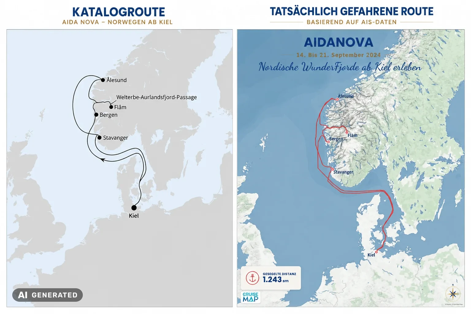
Before your cruise: planned the way commercial shipping plans.
No ship simply sails from A to B. Every passage is planned on the bridge: along established sea lanes, at a safe distance from shallows and through regulated traffic zones. We calculate your route on the same principle, using professional sea routing from port to port. That is why you can create your CruiseMap months before you sail.
After your cruise: from your ship’s real position data.
Every cruise ship continuously broadcasts its position via the AIS system. In raw form this data is unusable: false reports place the ship on another continent for a few seconds, hours are missing on the open sea, and dense clouds of points pile up in port. We check every position for plausibility, detect time in port, match it to harbors and validate every leg against the coastline.
“The idea that you just take the GPS track and print it doesn’t survive two days. Most of our development work goes into turning noisy raw data into a line that is nautically correct and still looks good.”
Leo Seidl, founder of CruiseMap
Three steps to your map
Choose your ship and travel dates
Your route with all ports is calculated automatically. There is nothing to draw.
Make it personal
Choose map style and format, upload your photo, add your names and slogan. The preview shows the result straight away.
Download and share
After purchase you download your finished map. No shipping, no waiting.
Frequently asked questions
Our database covers more than 350 cruise ships, from Royal Caribbean, Carnival and Norwegian to MSC, Princess and the other major cruise lines. You will see in the very first step whether your ship and your sailing are available.
For many ships, but not yet for all of them. The preview shows you exactly what your map will look like before you buy. Photo, ship illustration and distance table can each be switched on or off.
A bright photo in portrait format with your faces clearly visible. It does not have to be from this cruise: if you create the map before you sail, simply use a favorite picture.
Yes. If your cruise is still ahead of you, we calculate the route via sea routing from port to port. That makes the map a perfect countdown post and a lovely gift for anyone who has already booked.
CruiseMap social Personalized is optimized for screens. For printing we recommend the HD PDF or a finished piece of wall art. You will find both in the same map designer.
As a download right after purchase, and by email as well.
Too good to keep to yourself.
Create your CruiseMap social Personalized now and show family, friends and followers where you have been. Or where you are heading next.
$19.95 · instant digital download · free preview
Your CruiseMap. Your story. Forever.